Not All Aerial Imagery Is Created Equal
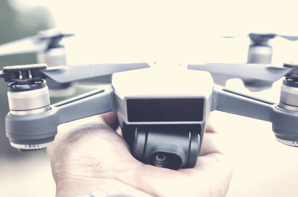
There’s a lot of buzz around drones being used in insurance. The compelling arguments for drones are:
- Much safer inspections ― there’s no need to climb on a ladder.
- They’re faster — drones can inspect roofs in less than 15 minutes.
- You can be safe and fast without sacrificing quality. Often, you can get better data with a drone.
Improving speed and safety are obvious benefits, but getting both without losing quality is where things get interesting. Data quality is different from one vendor to another, which makes it important to define data quality while exploring what’s possible with drones.
Raw imagery varies between drone cameras, but for most people, resolution is the big word in quality. More megapixels mean it’s better, right? Not quite. While resolution certainly plays a role in quality, the method of image capture itself and what can be done with imagery after it’s captured are huge factors as well. The conversation about quality changes when you think less about resolution, and more about what an adjuster needs to make great decisions. We define image quality in terms of how much it helps an adjuster confidently settle a claim.
UNDERSTANDING THE CAUSE OF LOSS
When the goal is to make fair settlements as quickly as possible, an adjuster needs to answer questions like: which areas were damaged and by what? What areas aren’t damaged? What damage existed before a specific event? Which kinds of damage are covered by the policy? To give adjusters data to help answer these questions, most drone inspection solutions rely on one type of scan.
LAWN MOWER SCANS - THE INDUSTRY STANDARD
Most drone solutions use the Lawn Mower Scan as its sole method to gather aerial imagery. The first set of images below is taken from the Lawn Mower Scan phase of an IMGING flight. In a Lawn Mower Scan, the drone flies at a safe distance above the roof and makes a few passes back and forth, essentially “mowing” the sky as it captures pictures every few seconds.
Let’s look at the quality of the imagery you’ll gather with a Lawn Mower Scan.
To help illustrate the effect of zooming in and out (notice the top right of each image), we’re using images as they appear in the IMGING™ Web App. IMGING is Loveland Innovation’s Insurance-specific drone solution.
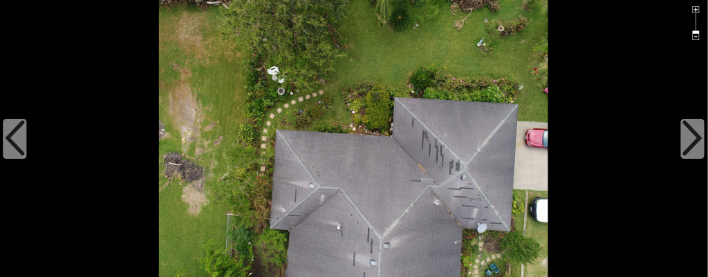
Above: Taken ~50ft above the roof
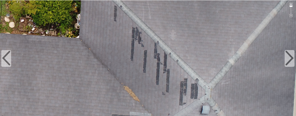
Above: Same photo, zoomed in to just before resolution breaks down.
With these, you can clearly see and document damage. But is it enough to investigate cause of loss? To investigate with confidence, you need images with even more detail.
Enter the Detail Scan.
DETAIL SCANS – THE LOVELAND INNOVATIONS STANDARD
IMGING goes a step further and uses patented autonomous flight control technology to fly close to the roof (~10-15 feet) to get much more detail. The purpose of a Detail Scan is to not only identify damage, but to provide a level of detail that enables adjusters to investigate for cause of loss.
Let’s look at the difference.
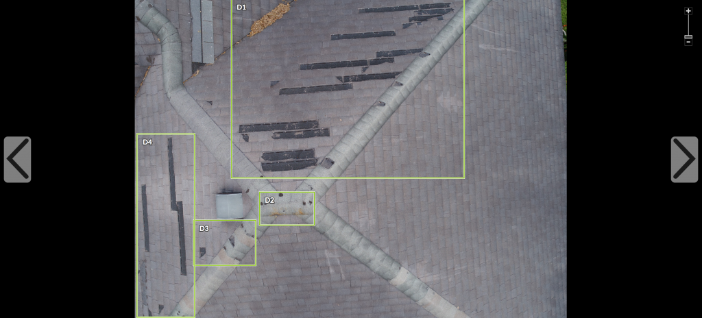
Above: The same area of the roof. Photo taken during a Detai Scan.
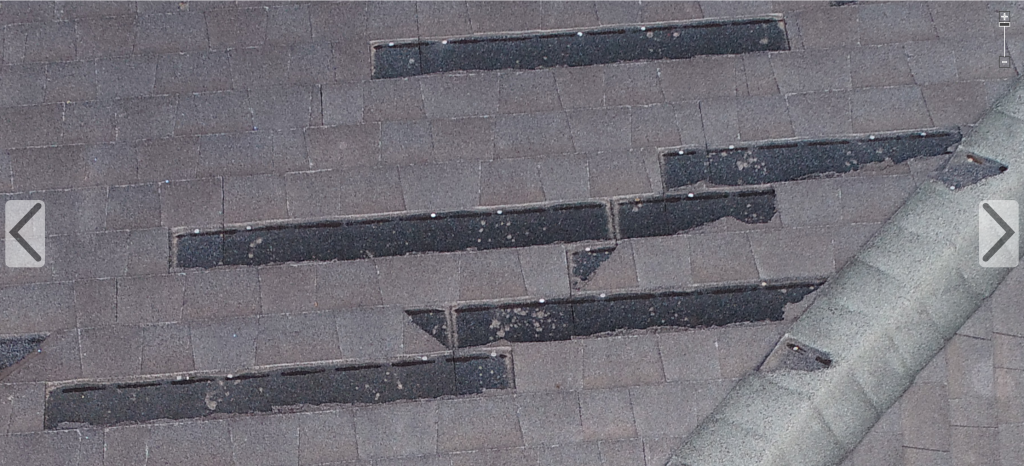
Above: A zoomed-in view of the Detail Scan
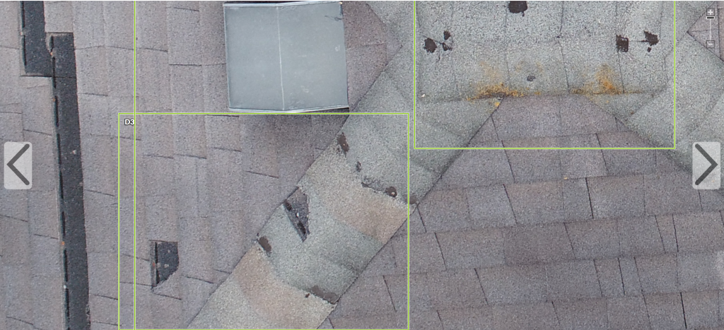
Above: Another zoomed-in view of the Detail Scan
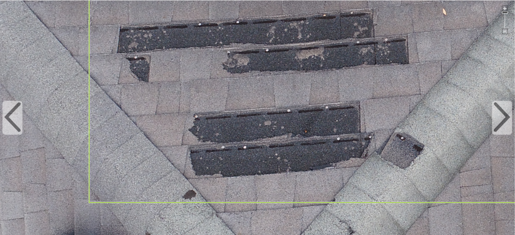
Above: Another zoomed-in view of the Detail Scan
THE DIFFERENCE IS IN THE DETAILS
These are just some of the images captured during this inspection. As we investigated each inch of damage with this set of photos, it became obvious that some of the damage was from earlier events.
IMAGE ANALYSIS POST-FLIGHT
As noted, what you can do with imagery post-flight is another factor that determines quality. In other words, how can you extend the value of the images you’ve captured? For instance:
- Can you generate 3D models and roof measurements with the imagery you’ve captured? Doing this is a function of capturing the right types of photos at the right locations of the roof and having a 3D modeling system that processes it.
- Can the data (images and otherwise) be easily organized, displayed, and shared with homeowners and other systems?
SO WHAT
Aerial imagery must not only be captured in a safe and fast way, but also:
- Be detailed enough for both identification of damage, and investigation of cause.
- Result in quantifiable data that can be used in estimating and settling claims.
Drones are great tech and when used to consistently gather, process, and deliver the right types of high-quality aerial data, they can be used by adjusters as a game-changing tool in the claims process.
Jim Loveland is the founder and chief executive officer of Loveland Innovation. He is a battle-tested business executive and innovator who has founded, grown, and led several extremely successful companies. He has lived and breathed in the insurance industry for almost thirty years and is passionate about pioneering technologies that will streamline and transform the industry. Previously, Jim served as President and CEO of Xactware for almost 10 years, as well as leading the insurance LOB for Verisk Analytics.
With a great passion for leadership and innovation, Jim has a proven track record of growing businesses both domestically and abroad, and is currently channeling his passion to succeed at his latest venture, Loveland Innovations. Loveland Innovations is focused on making insurance claims simpler and safer by creating the first entirely autonomous drone inspection solution built specifically for the insurance industry.
Jim holds a BS in Computer Science from Brigham Young University and an MBA from the University of Utah.